|
35°41' S, 137°45' E
Nepean Bay is actually 2 large coves the Western and the Eastern
Cove. They are divided at Point Morrison on the eastern most land
point. Matthew Flinders named the coves in 1802 when he sought safe
harbour in rough conditions and found it at what is now known as
American River - named in 1828 after the American sealers that set
up a base there. The town of Kingscote is on the Northern coast
of the Western Cove of Nepean Bay.
Kingscote is clearly visible on a clear day from the planes that
service the island as it is flown over on the way to the Kangaroo
Island Airport, which is located about 10 km out of the town of
Kingscote.
The Cygnet River flows into the western side of Western Cove and
a large floodplain extends to the southern side of the rivers mouth.
Birds nest here and most notable is the black swan.
Fishing in both coves is very popular and catches are good on most
days as there are various species of cold water fish there, these
include:
King George Sound Whiting
Tommy Ruffs
Garfish
Leather Jackets
Snapper
Snook
Trevally
Flat head
Wrasse
and a variety of small sharks and sting rays
The water of the coves is calm on most days and sheltered from the
most severe winds. However and despite this there have been shipwreck
like incidents here. Both occurred in the Western cove and
include:
'Fanny M'
1885 - composite vessel - ran aground at Point Marsden sand spit
- 11 crew - all survived - the ships cargo of coal subsequently
caught fire and the ship burnt totally
'Robert Burns'
1908 - schooner rig - Nepean Bay sand spit - ran aground and started
to take on water - number of crew unknown but there were no casualties
Holiday houses line the coastlines of both coves and the 2 towns
of American River and Kingscote are located on the northern sides
of Eastern and Western Coves respectively.
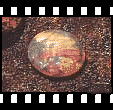
On the southern side of Western Cove is Redbanks and these bauxite
cliffs can be seen glowing red on sunset from the township of Kingscote.
|