|
The road runs
along the North Coast of Kangaroo Island and is in parts an iron-bauxite
road. Care should be taken on all roads of this type as they can
get slippery. This road provides access to a number of parks,
beaches and attractions.
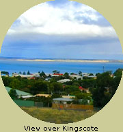
Starting at the
Emu Bay turn off near Kingscote, while travelling on the Playford
Highway, be aware that the road is shared by animals and keep
speeds down to allow time to stop if one of them should cross
your path.
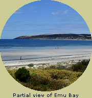
After reaching
Emu Bay, and spending time at the magnificent beach, you will
travel about 9 kms (5.6 miles) and find yourself against the coast
again at Smith Bay.
Veering away from
the coastline again, 7 kms (4.4 miles) will bring you within sight
of Mt McDonnell. Another 17 kms (10.6 miles) and you are travelling
through Lathami Conservation Park, one Island home of the endangered
Glossy Black Cockatoo.
3 kms (1.8 miles)
further and you are at Stokes Bay. Here you can visit a hidden
beach, which can only be accessed through a natural rock tunnel.
The North Coast Road then meanders for 10 kms (6.25 miles) crossing
an access road to the right that runs to King George Beach.
Drive another
5 kms (3.1 miles) and you are at Snelling Beach. A further
8 kms (5 miles) takes you into Western River Cove.
Leaving Western
River Cove a 16 kms (10 miles) trip will take you to Gosse and
back to the Playford Highway. Turning right onto the highway takes
you to Cape Borda and some stunning scenery along the way as you
traverse the North-eastern edge of the Flinders Chase National
Park and the Ravine Des Casoars Wilderness Protection Area.
Playford Highway
(West of Gosse)
Once on the highway
there are some stops that are scenically spectacular. 10 kms (6.25
miles) west of Gosse is a turnoff to the right, which takes you
along Colmans Road to the Western River Wilderness Protection
Area. You will find a walking trail called 'The Billygoat Trail'
which leads to the spectacular Billygoat Falls (flowing only after
rain).
Coming back onto
the Playford Highway and turning right takes you to Jump Off Road
after 10 kms (6.25 miles). This Road is about 7 kms (4.4 miles) long and at the end of this
road is the Cape Torrens Wilderness Protection Area. Here you
will find the tallest cliff faces in South Australia.
Re-joining the
highway and 15 kms (9.4 miles) further down the road is the Lighthouse
Keepers Cemetery, Harvey's Return and Scott Cove.
Another 1 km (0.62
miles) takes you to the Cape Borda Lighthouse, where accommodation
and guided tours are available.
Camping grounds
and Caravan parks can be found along the North Coast Road, as
well as Bed & Breakfast, Motel, and Cottage/Farm stay accommodation.
|